Sites with proper stormwater drainage protect businesses, residences, and city infrastructure such as roads, sidewalks, and parking lots from flooding and water damage. There are many factors that contribute to whether a project site is flood prone. These include offsite tributary runoff onto the property, rising flood waters from changing weather patterns, outdated or damaged infrastructure, surface materials, proximity to bodies of water, and any on-site or adjacent infrastructure. However, the topography of an area is the ultimate deciding factor on whether a site’s stormwater drains well, poorly, or not at all.
This is why an accurate topographic survey of the existing conditions of your project site should be the first step in creating your drainage and grading plan.
What is a topographic survey?
A topographic survey is a 3D map that describes features of a property, whether man-made or natural. Data in a topographic survey can include site location, area, boundaries, and elevation. It will show buildings, impervious coverage, adjacent public roads and utility mains, hills, creeks, drainage channels, and significant trees. It can also identify preexisting issues of a site such as low areas that become flooded seasonally or landscaping that interferes with the natural overland flood patterns.
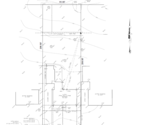
An accurate topographic survey conveys vital data to the civil design engineer to ensure that your project site will drain efficiently and with no harmful impact on surrounding areas. It will also ensure that the permitting approval process with the appropriate agencies is straightforward, streamlined, and timely.
How can Bono Consulting Civil Engineers help with my project’s topography?
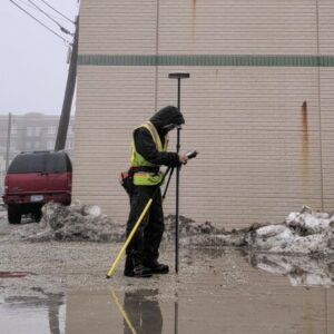
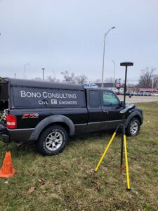
For 25 years our team has utilized robotic and GPS surveying systems to accurately assess project sites that require topographic evaluation for drainage issues. At BCI, our Field Survey Team relies exclusively on Trimble Geospatial Surveying equipment to perform topographic surveys for our clients. Trimble is the construction industry standard for precise and accurate measuring.
A complete topographic assessment of your project site will determine best practices for the success of your project. For more information on how Bono Consulting can help, visit the Topographic Surveys page of our website.